Back Thaba Nchu Afrikaans ثابا نشو ARZ Thaba Nchu (lungsod sa Habagatang Aprika) CEB Thaba Nchu German Thaba 'Nchu English Thaba Nchu Estonian Thaba 'Nchu French Thaba Nchu Malagasy Thaba Nchu Dutch Thaba 'Nchu NSO
| Thaba Nchu città | |
|---|---|
 | |
| Localizzazione | |
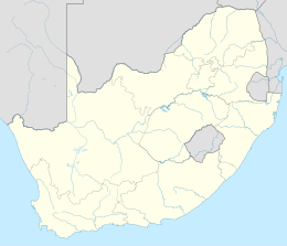
| Stato | |
| Provincia | Free State |
| Distretto | Non presente |
| Municipalità locale | Mangaung |
| Amministrazione | |
| Data di istituzione | 1893 |
| Territorio | |
| Coordinate | 29°12′S 26°50′E |
| Altitudine | 1 531 m s.l.m. |
| Superficie | 36,39[2] km² |
| Abitanti | 70 118[1] (2011) |
| Densità | 1 926,85 ab./km² |
| Altre informazioni | |
| Lingue | |
| Cod. postale | 9780 |
| Prefisso | 051 |
| Fuso orario | UTC+2 |
| Cartografia | |
 Thaba Nchu | |
Thaba Nchu (Thaba 'Nchu o Thabanchu) è un centro abitato del Sudafrica, situato nella provincia di Free State.
Situata 60 km a ovest di Ladybrand e 64 km ad est di Bloemfontein, la città fu fondata nel 1893 e prende il nome dall'omonima montagna che la sovrasta, il suo nome significa montagna nera in lingua sesotho[3].
- ^ a b (EN) Thabanchu, Main Place 499028 from Census 2011, su census2011.adrianfrith.com. URL consultato il 13 agosto 2020.
- ^ (EN) Thabanchu, su statssa.gov.za, Statistics South Africa (Stats SA). URL consultato il 13 agosto 2020.
- ^ (EN) Peter E Raper, Dictionary of Southern African Place Names, Johannesburg, Lowry Publishers, 1987, p. 430, ISBN 0947042067. URL consultato il 14 agosto 2020.